Artificial intelligence and geospatial satellite imagery have transformed construction site monitoring. This article delves into the integration of satellite imagery and geospatial data in the planning and execution phases of construction projects.
What is a construction site satellite monitoring
Construction site satellite monitoring refers to the systematic and technologically advanced practice of utilizing satellite imagery and geospatial data to observe, analyze, and manage construction sites. This method harnesses the capabilities of Earth observation satellites orbiting our planet to provide comprehensive insights into various aspects of construction projects.
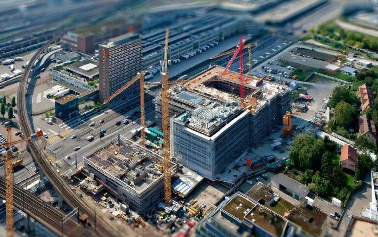
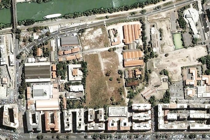
Through high-resolution satellite imagery, satellite construction site monitoring offers a bird’s-eye view of the entire construction area, allowing stakeholders to monitor progress, identify potential challenges, make informed decisions and compare past images with recent ones.
Also TimelapseLab in collaboration with the main satellite photos providers also offers to its client high-definition satellite images in order to monitor in real-time the construction site, to view maps in details and to plan future actions even from afar.
How the process works
The process involves the continuous acquisition of satellite images, allowing for real-time or periodic monitoring, depending on project requirements. These images capture intricate details of the construction site, ranging from structural changes to environmental conditions. Cutting-edge technologies, such as Differential Synthetic Aperture Radar Interferometry (DInSAR), enhance monitoring precision by detecting millimeter-level deformations in the construction landscape.
Construction site satellite monitoring is not confined to a singular purpose; rather, it serves a multitude of functions.
It aids in:
- project planning
- offering valuable data for environmental impact assessments, site development, and logistical considerations.
Moreover, it contributes to the enhancement of construction safety by enabling the identification of potential structural instabilities over time.
Benefits of using satellite monitoring in construction
The benefits of utilizing satellite monitoring in construction are multifaceted, significantly enhancing various aspects of project management and execution.
One of the primary advantages lies in the ability to obtain high-resolution images, offering unparalleled clarity and precision in tracking construction progress.
This real-time monitoring facilitate:
- timely decision-making, allowing project managers to respond promptly to any deviations from the original plan
- a comprehensive view of the entire construction site, aiding in effective resource allocation and logistical planning.
The cost-effectiveness of satellite-based monitoring cannot be overstated, as it eliminates the need for frequent on-site visits and manual data collection. Overall, the incorporation of satellite monitoring not only streamlines construction processes but also promotes sustainability by minimizing unnecessary disruptions and optimizing resource utilization.
Practical applications in construction site satellite monitoring
Incorporating satellite images in the early stages of construction projects serves a dual purpose.
Planning and site development
Firstly, during the planning and site development phase, these images play a pivotal role in crafting comprehensive environmental impact statements and site development plans. By showcasing real-time changes and providing detailed insights, satellite imagery becomes instrumental in ensuring compliance with environmental regulations.
Project setup phase
Secondly, in the Project Setup phase, satellite images streamline data acquisition, expediting the design process and substantially reducing analysis time. This not only enhances project efficiency but also aligns with environmental considerations by minimizing unnecessary delays. The utilization of satellite imagery in these practical applications not only accelerates project timelines but also contributes to a more environmentally conscious and streamlined construction management process.
Conclusion
Satellite monitoring revolutionizes construction management. From environmental compliance in planning to accelerated project setup, it ensures efficiency and precision. With real-time insights, it becomes an indispensable tool, propelling construction into a future of sustainability and success, just like TimelapseLab does.